
The Fort Myers Boat Show returns with hundreds of boats spread throughout Downtown Fort Myers along with boating accessories, services, seminars, food and live music.
With exhibits extending throughout the downtown waterfront, Centennial Park and the 35,000-square-foot convention center, there is plenty to explore.
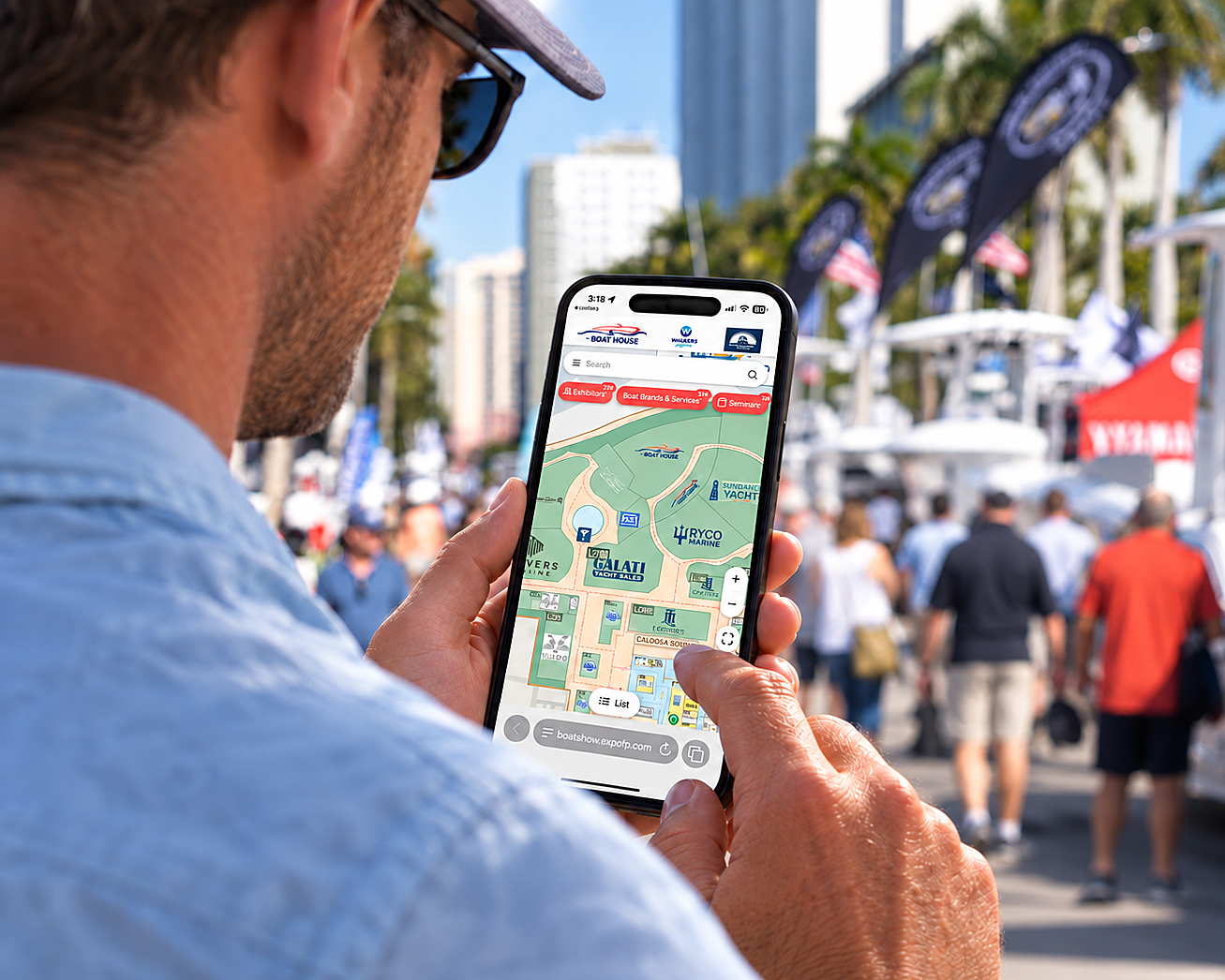
New this year, the Fort Myers Boat Show’s interactive map makes it easier to plan your visit and find your way around the show. Discover which boat brands are on display, locate exhibitors and marine products, and get step-by-step walking directions, all from your phone, with no app download needed.
More Than a Show Layout
Unlike a traditional printed map, the new Fort Myers Boat Show Interactive Map allows you to search and explore the show directly from your phone, tablet or computer. (Map opens directly in your web browser – no need to download an app)
Looking for a particular exhibitor? Enter the company’s name in the search field to locate its display. Interested in a certain boat brand, product or marine service? Find out which boat brands are on display and where to see them.
Selecting an exhibitor opens its profile, which includes its location and available contact information. From there, you can view the booth or display area on the map, share the listing, save it to your bookmarks or mark it as visited.
Selecting an exhibitor opens its profile, which includes its location and available contact information. From there, you can view the booth or display area on the map, share the listing, save it to your bookmarks or mark it as visited.
Create Your Own Route
Looking for a particular boat brand, exhibitor, product or marine service?
Select an exhibitor or search our categorical index and tap “Directions.” Allow location access to get walking directions from your current location or select a starting point manually.
This can be especially useful if you have several exhibitors, boat brands, or seminars you want to visit. Search for them before arriving, save the locations that interest you, and create a more efficient path through the show.
You can also use the map to locate:
– Parking areas
– Shuttle stops
– Show entrances
– Seminars
– Restrooms
– Food and beverage locations
The map can be enlarged, reduced, or reset to show the full event area, allowing you to examine individual exhibit spaces or regain your bearings with a broader view.
Use it Before and During the Show
The interactive map is helpful both when planning your visit and while walking the show.
Before you arrive, spend a few minutes searching for the exhibitors and products you most want to see. Bookmarking those locations can provide a personalized starting point for your day while still leaving plenty of time to discover something unexpected.
Once you are at the show, keep the map open on your phone. You can use it to find your next stop, check nearby exhibits, locate a seminar, or identify the nearest entrance, restroom, or food option. Marking exhibitors as visited can also help you remember where you have already been, particularly if you plan to compare several boats or products.
Because exhibitor information and show details may continue to be updated, check the map again as the event approaches.
Start Planning Your Day
The Fort Myers Boat Show offers boats of many types and sizes, marine accessories, fishing and boating seminars, food trucks, live music and more, all in the heart of the Downtown River District. Convenient parking and free shuttle service are also available.
Explore the Fort Myers Boat Show page for event information, then open the interactive map and start building your must-see list.
A little planning can help you spend less time searching and more time enjoying everything the Fort Myers Boat Show has to offer.