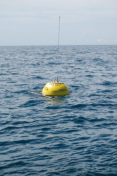
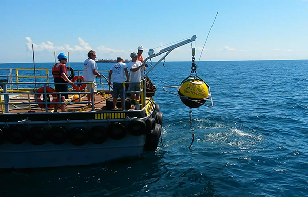
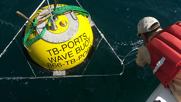
A new wave monitoring buoy (WMO ID 42098) was deployed on June 5, 2015, near the entrance to the Tampa Bay shipping channel, 10 miles west of Egmont Key. The addition of this buoy to the existing NOAA Physical Oceanographic Real Time System (PORTS) network builds upon the existing measurements of winds, currents and tides around the bay. Instruments on the Waverider buoy provide harbor pilots and other boating interests with real-time data on wave height, period and direction, critical information to enhance safety as the pilots move between the station and inbound or outbound ships. Recreational boaters will benefit as well from knowing wave conditions before venturing offshore. Data from this buoy along with a video and photos of the deployment are available at http://tbports.org.
Funded by the Greater Tampa Bay Marine Advisory Council – PORTS, Inc., the local operator for Tampa Bay PORTS, and operated in collaboration with the University of South Florida College of Marine Science and the US Army Corps of Engineers-funded Coastal Data Information Program at Scripps Institution of Oceanography (CDIP), the information also supports broader efforts to monitor and predict waves and shoreline change.
“While the primary beneficiaries of wave data from this buoy are the Tampa Bay Pilots and related shipping interests, the wave information is critical to studies of beach erosion and channel dredging” said Mark Luther, the head of local operations for Tampa Bay PORTS.